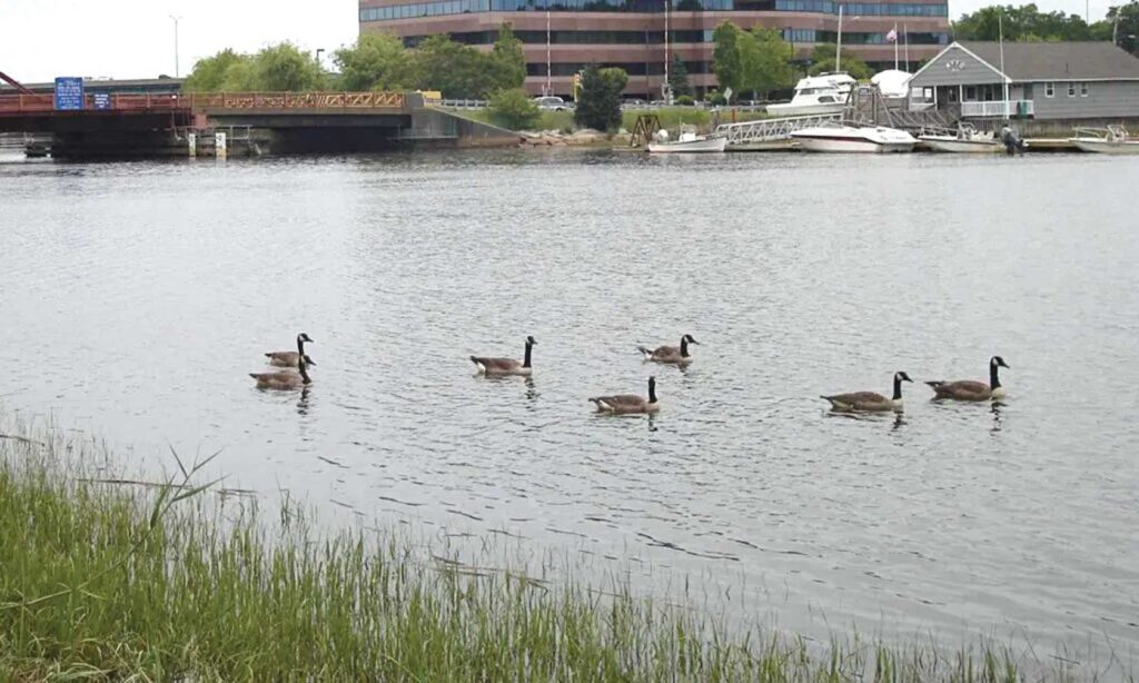
Along the Neponset, advocates look to balance remediation work with potential future use

When the Environmental Protection Agency declared the Lower Neponset River a Superfund site in 2022, community members celebrated it as a recognition of the community’s need and a way to bring faster repair to a natural resource.
Now, with that work underway — the EPA already completed work at the Lewis Chemical site, further up the river in the fall—visions for what could be next for the spaces along the river are percolating on the horizon.
The river is contaminated with polychlorinated biphenyls, or PCBs, man-made chemicals that were a part of industrial production for decades from the late 1920s until 1979 when they were banned by U.S. law. Exposure to PCBs can lead to a host of health concerns, including an increased risk of developing cancer.
The EPA formally proposed a 3.7-mile stretch of the river — from its confluence with Mother Brook in Hyde Park to Lower Mills’ Walter Baker Chocolate Dam — on the list of Superfund sites in late 2021. It was officially added in March 2022, opening more opportunities to address the contamination from the PCBs as well as other pollutants, like heavy metals.
And, once cleaned, the river — in which officials warn against swimming, wading or catching fish to eat — could be a spot for its neighboring communities like Mattapan, Hyde Park, Dorchester, and Milton to have increased access to green space.
At Riverside Square in Hyde Park, one of two priority spots identified by the EPA that are being addressed in the first phase of work, that vision includes potential new opportunities for Hyde Park neighbors. At the heart of it is an idea of what that space along the river could offer: a green space with a walkway by the river and benches to sit on and enjoy a little spot of nature.
For the community, it would mean access to greenery and waterfront that the city’s communities of color often have less access to.
“This section of the river has been very hard to access for many, many decades, and people are starting to again realize the opportunity that they have here in their own community,” said Andres Ripley, greenways program director at the Neponset River Watershed Association. “When the river is cleaned up, they’ll have a beautiful amenity that they can access without having to drive somewhere far away.”
Marilynne Smith Quarcoo, a Hyde Park resident, pointed to the benefits of existing green space further along the river, near Mattapan Square, where the Neponset Greenway weaves alongside the river through tree-lined corridors.
“I’ve seen women just sitting on a bench, and I’m like, ‘Oh, hey, sister, what are you up to?’ And she said, ‘I just need some place to sit and just calm myself down.’ That’s it. Who shouldn’t have access to nature?” said Smith Quarcoo, a member of the organizing committee of the Superfund Community Advisory Group, a collection of community members who advise and inform the EPA in their work.
Smith Quarcoo, who moved into her Hyde Park home about 40 years ago, said she’s long been aware of the presence of the river, but said some of her neighbors don’t even realize it exists.
But the vision for the Riverside Square site may hinge, at least in part, on how the EPA handles the remediation and removal work at that site now.
In a letter sent by the Neponset River Watershed Association to the EPA in November, the group raised some concerns regarding how the planned work at the site could impact future development.
Currently, the EPA plans, overall, to remove the top foot of soil across an estimated 1.8 acres at the site. At hotspots — areas in which long-term sampling and testing of the soil by the EPA and the state Department of Environmental Protection have identified higher contamination—the EPA plans to remove the top 3 feet of soil.
Ripley said he has been told that those depths represent the agency’s estimates of how deep they need to go to remove contamination. If, in the process of removal, they identify more contamination, they will remove more soil.
Once removed, the area will be “capped,” a process that refers to covering the area with a geotextile fabric and a layer of clean soil.
According to an EPA spokesperson, contractors mobilized onsite at Riverside Square in October and the clean-up is expected to be completed later this year or in early 2026.
But Ripley said he and the watershed association have some concerns that how that cap is situated — as well as how willing the state Department of Conservation and Recreation is to possibly amend it later, during the potential construction of a park—might impact what sort of trail and infrastructure can be installed.
“When you create a trail, depending on how robust you want it to be — if it’s just crushed stone dust, if it’s dirt, if it’s actually a multi-use paved trail that has to go down a few feet — the geotextile fabric can impact what kind of trail you can create,” he said.
The group is advocating for a capping process that will leave a significant layer of soil above the geotextile fabric to make the construction of a path easier. But they’re also asking that the solution doesn’t sharply raise the height of the site.
Already, Ripley said, access to the water’s edge is challenging due to steep banks that are a carry over from the area’s industrial days, when the land along the river — including the site at Riverside Square, which was built out to straighten and alter the river—was set up to get the water flowing as fast as possible to harness its power.
“The biggest and most important part is that we have a clean and safe river for people, but it only does so [much] good if you clean up the river and the banks and they’re not accessible, right?” Ripley said.
Both Smith Quarcoo and Ripley said the EPA team has been highly responsive in answering community questions and working to address concerns.
When it comes to future work at the site, Ripley said that, in conversations between the watershed association and DCR, the state has been positive about the idea of building a trail or park in the area, even if they haven’t committed to any specifics.
In a statement to the Banner, a DCR spokeswoman was noncommittal about what work might take place at the site following the remediation work but said the department looks forward to collaborating with the EPA and other stakeholders.
“We are reviewing the ongoing EPA cleanup and property interests at a variety of locations along the Neponset in order to determine which, if any, of the conservation and recreation goals laid out in the Neponset River Reservation Master Plan could be furthered in the Riverside Square area,” the department said in a statement.
For its part, the EPA distanced itself from any work on what will happen at the site after remediation is complete and directed questions regarding the topic to the state in a statement sent to the Banner.
One prominent goal of the vision would be that the path would be continuous, linking the nearby West Street Urban Wild and Doyle Park — another DCR-owned space that has, in recent years, been gearing up for plans to redesign and revamp the space.
“The opportunity to have a connection from that Doyle Park project that DCR is starting construction on soon, upstream along this parcel to the West Street Urban Wild, opens up about a third of a mile of riverfront that has not been accessible previously, and [will be] cleaned and has the opportunity for the neighbors to go down there in the local Hyde Park community and enjoy nature in their own neighborhood,” Ripley said.
Smith Quarcoo, too, said she’d like to see an extended path, but her vision would connect beyond the third of a mile that would be opened with the Riverside Square site, extending farther up and down the river. For that, she’d like to see state and local agencies that own various parcels come together.
She encourages community members to educate themselves about what options might exist for that kind of space, saying, “Sometimes, we don’t know what we need to know.”
“As people are asking for those hard, black-top surfaces along that pathway, I’m thinking, ‘Hmm, they must not know that there are these porous surfaces that we really should be thinking about,’” she said (blacktop surfaces and other impermeable pavements can increase heat in an area and cause challenges around flooding during storms).
Despite the questions that remain, its potential is promising for community members and supporters of the river.
“I do see it has this potential gift, if we can all put it together, right?” Smith Quarcoo said.


