Somewhere in the future, Ian Cooke envisions a Neponset River where canoes paddle lazily down the water, families sit along the banks in Hyde Park and Mattapan, birds fill the air and migratory fish can swim freely up and down the waterway. Perhaps even some new restaurants line the clean, attractive river.
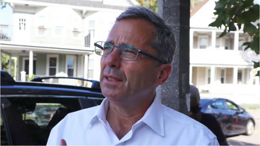
“The river really should be a resource that everybody can enjoy and take advantage of, a place to go relax, to recreate a little oasis within the city,” said Cooke, the executive director of the Neponset River Watershed Association.
For now, that vision is still out of reach. Much of the waterfront is fenced off. A couple of dams block the path of the fish. Centuries of industrial activity along the banks, going back to river waters powering mills and factories, have left the river polluted with contaminants.
But work along its shorelines is starting to change that as the U.S. Environmental Protection Agency works to clean contaminated sediment and other sources of pollutants from the river, which was placed on the EPA’s Superfund National Priorities List in 2022. The agency released an update on its work last month.
The river is contaminated with polychlorinated biphenyls, or PCBs, man-made chemicals that were a part of industrial production for decades from the late 1920s until 1979, when they were banned by U.S. law.
Along the Lower Neponset, PCBs were used in the manufacturing of such products as electronic mechanisms and carbonless copy paper.
The chemicals floated downstream where they got caught in sediment behind dams along the river’s flow.
Exposure to PCBs can lead to a host of health concerns, including an increased risk of developing cancer.
The EPA formally proposed a 3.7-mile stretch of the river — from its confluence with Mother Brook in Hyde Park to Lower Mills’ Walter Baker Chocolate Dam — on the list of Superfund sites in late 2021. It was officially added in March 2022, a move that was celebrated for the opportunity to bring increased attention and accelerated remediation efforts to the river.
The first phase of efforts under the Superfund designation, part of what the EPA calls “remedial investigation,” focused on the first section of the river, stretching about a mile from Mother Brook to the Tileston & Hollingsworth Dam. Phase Two will sample and consider the rest of the river through to the Walter Baker Dam.
Following environmental assessments before the Superfund declaration, that first chunk of the river was identified to be more contaminated, and therefore a higher priority, to address, according to Jo Anne Kittrell, an EPA spokesperson.
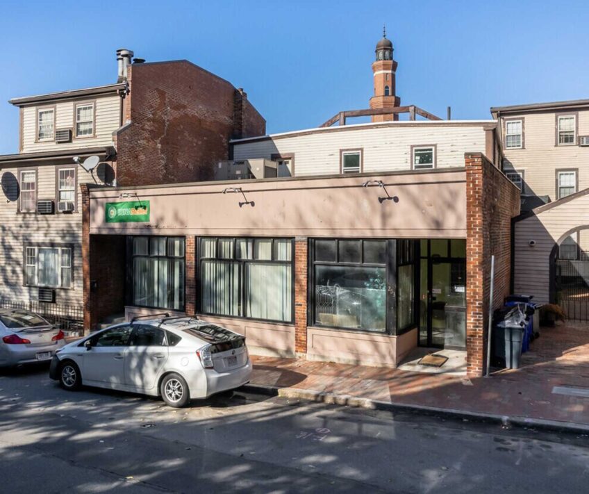
Under the first phase, the EPA focused efforts at two sites along the river, the former Lewis Chemical facility, near the Fairmount MBTA station, and the Riverside Square PCB site.
At the Riverside Square site, in areas where the river was straightened the banks were filled in with soil polluted with the PCBs and other contaminants. Last year, the EPA collected about 500 soil samples and plans to remove contaminated soil from the site, starting this fall.
The Lewis Chemical site, a former industrial facility that collected, transported, and stored materials that contained PCBs, caused nearby contamination. Starting last year, the agency began to excavate contaminated soils, with work finishing this fall.
Cooke said the old Lewis Chemical facility site showcases the possibilities that make him excited about the efforts the EPA is engaging in. The area has long been fenced off, but once cleaned, he hopes it could be a place where community members will be able to gather and enjoy the river.
“I think most people, if you said, you were going down to the waterfront in Hyde Park, they would be like, ‘What? What are you talking about?’” Cooke said. “The river goes through Hyde Park for quite a distance, but it’s always been completely fenced off and inaccessible to the community. That’s part of why what they’ve already done with the Lewis Chemical site is exciting, because that’s a big piece of waterfront that has been fenced off for decades. Now, hopefully, in the not-too-distant future, the community is going to start to have a chance to re-envision what can happen there to make it into some place you can go and enjoy.”
Overall, the process has been going “faster than most people would think,” Cooke said.
That’s been due to goals under the Superfund Accelerated Cleanup Model, an EPA process developed in the early 1990s, that aims to streamline work to remove years from the timeline with early action steps — like removing contaminated sediment at the two phase one sites on the Neponset — in addition to long-term clean-up efforts.
Those early actions allow the EPA to address priority risks and more sites more quickly through the Superfund process, Kittrell said.
Throughout the fall, the EPA will shift its focus to the other 2.7 miles of the river that are included in the Superfund designation, collecting mussels, fish, sediment and surface water samples, Kittrell said. That work will help the agency identify if further sampling is needed.
The ongoing work also has included the onboarding of a Community Advisory Group, a collection of local voices tasked with giving input to the EPA, as well as being a link to report back to surrounding neighborhoods and help share what information is released.
Kittrell called the group and the input they will provide “invaluable in decision-making during all steps of the clean-up.”
Cooke called the group’s voice in the work, “critical.”
“The EPA is not doing this to benefit Washington, D.C., they’re cleaning this up so that the community can be safe from environmental pollutants, but also so the community can ultimately have the river they want to have,” Cooke said.
Having a collection of local voices to inform the work and connect back to the community at-large will be important, especially during a clean-up process that will likely be somewhat disruptive to local neighborhoods, he said.
“[The EPA] also needs to have input on know what this river should ultimately be, so they are doing the cleanup in a way that honors what the community’s priorities are,” Cooke said. “Nobody can do that but local people who live in the area.”
And the work could potentially open up other avenues of restoration work along the river. Concerns around PCBs in the Neponset became heightened as community groups and state agencies started to dig into the idea of removing the Walter Baker Dam and the Tileston and Hollingsworth Dam to restore passage for migratory fish that live most of their life at sea but lay their eggs up the river in fresh water, Cooke said.
Currently, those two dams block the path of fish like herring, shad and alewife — a species of fish that, ultimately, leant its name to the MBTA Red Line station — from accessing the next 17 miles of the river upstream.
“That idea of what to do about fish has kind of been on hold for a long time as we’ve figured out what to do about the contaminated sediments. Now that the contaminated sediments are starting to be dealt with, the idea of what’s going to happen with the fish is coming back.”
Progress on remediating the contaminants around those dams could let work around either removing or rebuilding the two dams, both of which are at the end of their design lives, move forward.
Cooke said community conversations a decade-and-a-half ago showed support for removing Tileston and Hollingsworth Dam but potentially keeping the Baker Dam in place but installing a nature-like fishway. That addition, which generally creates a gradually-sloping channel with gravel and boulders for fish to traverse, allows the migratory species to go upstream, while also working to restore habitat.
Efforts like dam removals and installing other ways for diadromous fish — those that migrate between salt water and freshwater, like the ones that used to traverse the Neponset — have been identified as important steps to bolster the fishes’ population which has been declining in recent decades.
Kittrell said the EPA is evaluating both the repair and the removal of the Tileston and Hollingsworth Dam as part of its work.
The Tileston and Hollingsworth Dam has started to fall apart —these days, water flows through, rather than over it, Cooke said — making it a good candidate for removal. But the question of whether keeping the Walter Baker Dam but installing a fishway continues to be the best option, is a conversation that he said should be revisited based on broader factors that have shifted in the interim.
A new and heightened focus on how a changing climate impacts flooding means that the potential impact on surrounding neighborhoods is now another factor to consider when it comes to deciding to keep or remove the dam.
“I think one of the things we are aiming to do over the next year is to try to re-examine aspects of the Baker Dam and to understand with climate change, sea level rise, but also more intense flooding, is keeping the dam or building a nature-like fishway going to cause flooding in the neighborhood or not?” Cooke said. “If it is, it doesn’t make a lot of sense to preserve the dam.”
Exactly what communities can expect from the river, once the EPA’s work is done years from now, is still in the air. Kittrell said that until the agency completes and releases its Engineering Evaluation and Cost Analysis — an official report identifying the goals, effectiveness and cost of possible solutions at the site — any solid, official assessment of what, if any, limitations will exist on how the river will be able to be used can’t be made.
An initial version of that evaluation, to be released for public comment, is expected to be published this fall.
Already, some recreation is permitted and considered safe along the river. According to a 2022 release from the state’s Department of Public Health, published following the Superfund declaration, activities like rowing and kayaking on the river and walking and biking alongside it are safe, given limited contact with contaminated water or sediment. Catch-and-release fishing, too is considered safe, but officials warn against swimming or wading in the river.
But, for Cooke, the fact that conversations like what to do with the dams are now possible to consider is an indication that efforts around removing contaminants in the river are moving in the right direction and that, sooner rather than later, communities along the Neponset River will be able to have new conversations about how to use restored and re-opened space on its banks.
“Who knows exactly how it will all come together, but it really should be a center of the community that brings people from all walks of life together and just makes these neighborhoods, in these communities, the special places that they are,” Cooke said.