Coastal resilience efforts cross city lines at Island End River in Chelsea and Everett

As a low-lying coastal city, Boston is at heightened risk for coastal flooding. To examine the challenges and opportunities of coastal resilience efforts, the Banner is digging into three sites along the metro-Boston shoreline where flooding could pose high risks and solutions are being crafted to create new models for the future. Part 3 of the series examines Island End River in Chelsea and Everett.
The Island End River cuts inland right at the line between Chelsea and Everett, following the municipal border for its 2,500-foot length.
That distance — about the length of eight football fields — is currently strewn with trash. Tall, reedy invasive phragmites crowd the marshy area tucked away behind fences. A park at one end is accessible only through one boardwalk backed by a row of warehouses.
But officials from both cities it touches are looking toward a future where the banks can be clean, the native salt marsh can be rejuvenated, the park can be more accessible, and the area can serve as flood protection for vital infrastructure and at-risk residential communities behind it as the area faces growing potential threats from a changing climate.
“Climate change is incredibly scary,” said Emily Granoff, who manages the project for Chelsea. “It’s going to have really terrible impacts for a huge number of people, especially in environmental justice communities, like Chelsea and Everett. We talk about that a lot at the federal level and at the state level, but small communities like Chelsea and Everett, we are taking action.”
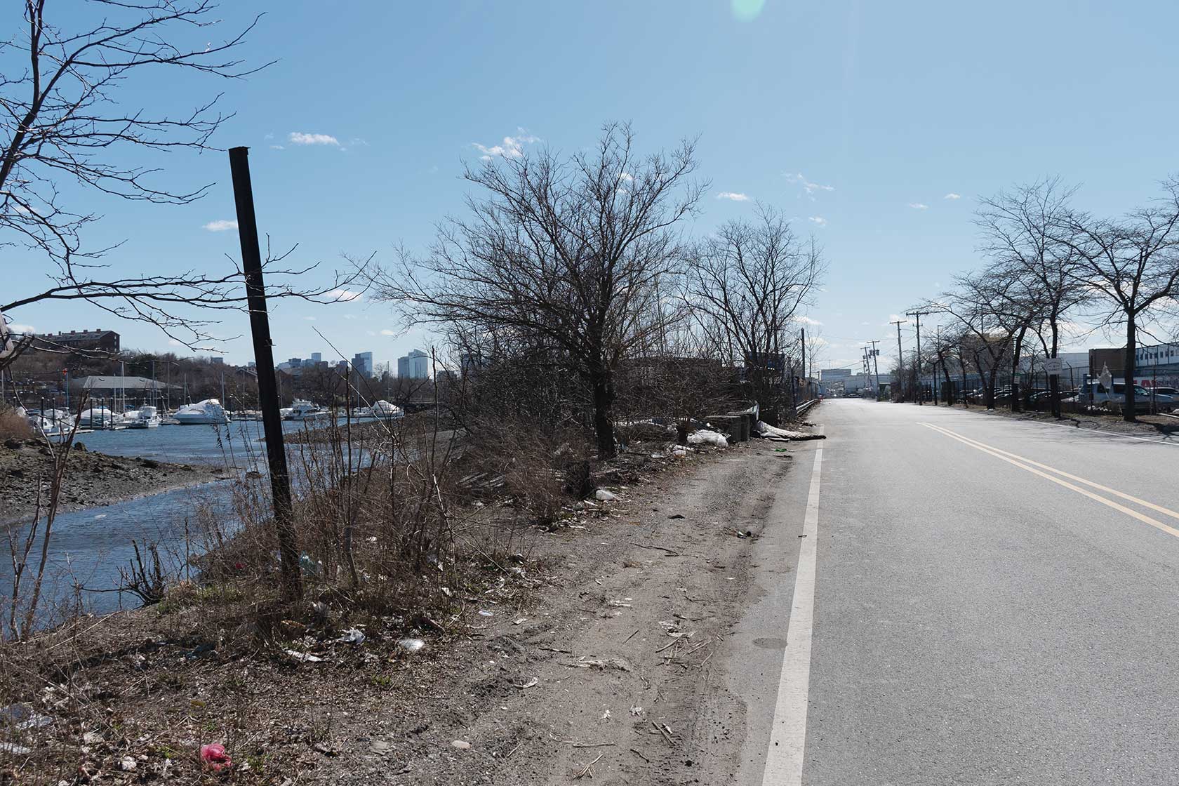
The Island End River flows to the left while Market Street runs to the right at the site of the Island End River Project. The coastal resilience effort will include a storm wall that will run for over 4,000 feet down the street to protect infrastructure and residents in Chelsea and Everett. BANNER PHOTO
The strip of land right around the Island End River Project offers little protection to the nearby New England Produce Center, the hub of fruit and vegetable distribution for all of New England and up into Canada. Further back, there’s transportation infrastructure like the Chelsea Commuter Rail station, one of Mass General Brigham’s outpost health centers, a high school, and the homes of about 5,000 residents.
All of that sits in a flood plain that could, under some projections, see up to four feet of flooding with storm surges by the year 2070.
To mitigate that flooding, the project, co-managed by both cities, will include construction of a storm wall, restoration of native marshland, renovations to a local park and the addition of a storm surge-control facility that will block one of the culverts that normally drain water into the river to keep water from flowing the wrong direction during storms.
“I can’t speak highly enough of how cool this project is,” said Patrick Johnston, who manages the project for Everett.
The resilience effort has received attention — and funds — thanks to U.S. Rep. Ayanna Pressley, who channeled $750,000 in federal funding to it through community project funding, formerly known as earmarks. That money was allocated in 2022 and officially delivered at a roundtable event in February of this year.

Rep. Ayanna Pressley (center) presents $750,000 in community project funding to officials from Chelsea and Everett for the Island End River Project, Feb. 20. The project, a jointly operated coastal resilience effort, will build a storm wall and restore native salt marsh to protect residents and infrastructure who could face up to 4 feet of flooding by 2070 during storm events. BANNER PHOTO
Pressley called the project “visionary” and said efforts like this are important for centering environmental justice communities. Only one census block each in Chelsea and Everett doesn’t qualify under the guidelines focused on income, language access and percentage of the population that is a minority.
“As policymakers advance the investments necessary to make our communities more climate resilient, environmental justice must be front and center,” Pressley said at the event. “It is policy and these budgetary investments that will make the difference in closing so many of the inequity gaps that we see persistent throughout this congressional district, but in particular in Chelsea and Everett.”
Building walls to keep out the water
One key piece of the Island End River Project will be a storm wall, running for just shy of 4,500 linear feet down Market Street on the Everett side of the project.
Compared to other pieces of the Island End resilience efforts, or some other coastal resilience projects in and around Boston, the example of “gray infrastructure” — projects using things like concrete or steel — is something of an outlier.
On the map of coastal resilience projects, where the city of Boston tracks the projects it’s planning or has done along the city’s 47-mile coastline, much is marked with the green of elevated parks and berms and the teal of nature-based solutions. The grey areas indicating seawalls and floodwalls appear in only a handful of spots, most of them industrial places like the cruiseport in Seaport or along the edge of the MBTA’s Orient Heights rail yard.
At Island End River, Johnston called the wall something of a second-choice solution. He said nature-based efforts would be preferable, but restrictions on the Everett side from its federal designation as a port area and a history of environmental contamination in the area limits what solutions the team can employ.
Partway down Everett’s riverbank, a confined disposal facility — a way of isolating contaminated substances — holds heaps of the river’s sediment dredged in 2007 and contaminated with byproducts from a coal tar production facility that existed alongside the river from the late 1800s until the mid-1900s.
“We have already pushed nature so far that there’s nothing for us to do but make another built solution,” Granoff said.
For people working in coastal resilience, nature-based solutions are often preferable, offering additional benefits like managing stormwater, increasing biodiversity, sequestering atmospheric carbon, or providing green space for community members.
They can also have a longer lifetime. The wall, once installed, will be designed to withstand strong waves from the river side, and the possibility of truck or car drivers colliding with it from the Market Street side, Granoff said. Even with the best efforts, however, it will eventually need to be replaced or repaired in a way nature-based solutions, when done right, won’t require.
“Nature-based solutions are, when you can do them really well, self-healing,” Granoff said. “They’re more aesthetically attractive; it often results in creating open space that we can enjoy, whereas this is a wall, when you get down to it.
Supporting nature’s ‘big sponge and filter’
The use of the storm wall will not replace nature-based solutions at the site altogether. On the other bank of the river, existing salt marsh will be revitalized with work on removing trash and invasive species like phragmites, a type of tall reed brought over by Europeans that has since spread wildly across the United States, often outcompeting native species.
Salt marshes used to be plentiful along the New England coastline, but climate change and development decimated the habitat. According to a 2005 paper that looked at historical maps to calculate an estimate for how much marsh had been lost over the years, by the early 2000s, Massachusetts had lost 41% of the salt marsh it had in 1777. The Boston area specifically had lost about 81%.
“That kind of saltwater marsh used to be a huge part of this area,” Granoff said. “It will do a lot to help, like, absorb and retain water.”
The marshes, like the one the Island End River project will restore, provide a host of benefits, slowing and buffering water coming in from tides and storm surges and filtering nutrients and contaminants in runoff coming toward the harbor.
Robert Vincent, an environmental scientist and the assistant director for advisory services at the MIT Sea Grant College program, called the marshes “a big sponge and filter.”
They can stabilize coastlines, collecting sediment and plant material through a process called accretion to grow and create a natural, raised area that can protect against tides and floods. They also provide habitat for both land and sea creatures, like birds, crabs and fish.
And healthy marshes are major “carbon sinks” — areas that collect and hold more atmospheric carbon than they release. According to a 2023 report from the Environmental Protection Agency that Vincent helped author, they can hold between four and 10 times more carbon than the same size area of a forest — carbon that is stored by the marsh, rather than contributing to climate change.
But rising seas pose challenges to the health of salt marshes. Increased flooding on the marsh surface can prevent plants from growing, which eliminates the protective nature of the marshes, and releases the carbon they’ve stored back into the atmosphere.
Development, especially between the mid-1800s and the 1970s, when the federal government and general public found greater recognition of the benefits of the habitat, also reduced the size of marshes across the region.
Vincent said he’s excited to see increased efforts around salt marsh restoration, and said he thought more coastal resilience efforts should include the marshes as an element.
“We’ve lost so much of this habitat, and it’s very important to continue to restore and conserve these habitats,” he said.
Resilience across city lines
Just past the current reaches of Island End River, the border between Chelsea and Everett takes a strange bulbous bend through the New England Produce center, the kind of line Granoff said no surveyor would do without good reason.
The shape is a memory of the original path of the Island End River, which was about twice its current length, and which marked the boundary between the two cities before a little over half was filled in.
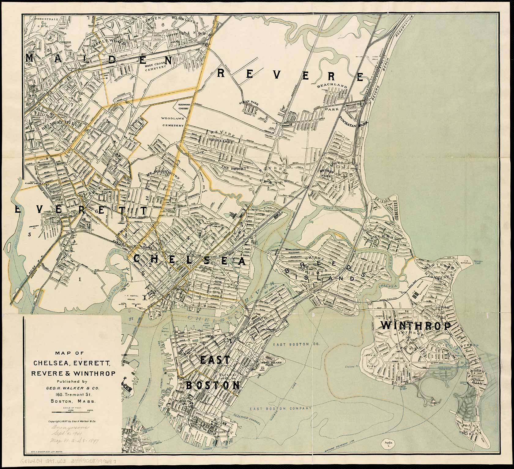
A 1897 map shows Chelsea, Everett, Revere, & Winthrop. Island End River — as it appeared then, before half of it was filled in — appears toward the bottom left, above the legend. MAP: courtesy of George H Walker & Co.
Though the project falls right on the municipal line between Chelsea and Everett, it isn’t falling between the cracks. The work has prompted an intermunicipal agreement — a deal between the two cities passed by both city councils and signed by both executives that sets rules for the project managers to work together — and cost-sharing agreements that will impact both the project’s construction and maintenance.
The state, too, recognizes that resilience efforts need to cross official boundaries. As part of Resilient Coasts, an initiative announced by the Healey-Driscoll Administration in November, the state’s Office of Coastal Zone Management will create a system of coastal resilience districts along Massachusetts’ about 1,500 miles of shoreline.
Those districts will take into consideration things like physical characteristics of an area and vulnerabilities that might benefit from a shared resilience strategy but will ignore jurisdictional distinctions.
“One of the really key priorities here within Resilient Coasts is to bring this planning process and even the visioning of what resilience means to Massachusetts, beyond the municipal level, knowing that these climate impacts are not going to follow municipal boundaries, or even state boundaries,” said Lisa Berry Engler, who at the time of a January interview was assistant secretary and director of the Office of Coastal Zone Management. She has since transitioned to serve as deputy managing director of offshore wind at the Massachusetts Clean Energy Center.
The intermunicipal agreement at the heart of the Island End River project isn’t common, said Granoff — in her whole career with state and local government she hadn’t heard of that kind of partnership until her work on this project — but it doesn’t mean municipalities aren’t coming together in other ways, said Julie Wormser, senior policy analyst at the Mystic River Watershed Association.
Across that watershed, 20 cities and towns have joined the Resilient Mystic Collaborative, a coalition of municipalities working together to address flooding and resilience as it relates to the river. Island End River is a tributary of that larger body.
Together, they’re working on nine interventions — including the work at Island End River — along the Mystic and Charles Rivers that would close flood pathways and prevent flooding in about 7,500 acres of land across 15 surrounding municipalities.
“Climate change is really a collective action problem,” Wormser said “You do have to manage climate at a regional level and here’s an example.”
All of those projects have to happen in conjunction and in coordination.
For example, just building the wall and restoring the marsh at Island End River will prevent the worst of the predicted four feet of flooding that would come from that direction, but without raising the Amelia Earhart Dam and Draw Seven Park in Somerville further up the Mystic River — or without raising it enough — water could still seep around and leave at least a few feet of flooding in the area.
“When we’re talking about floodwater, we need to all be pulling in the same direction,” Granoff said. “There’s no way it’s possible to just protect ourselves, nor would we really want to.”
Want to read more? Check out Part 1, looking at Dorchester’s Tenean Beach, here, or Part 2, on South Boston’s Moakley Park, here.


