City releases audit of publicly-owned land
Audit reveals 1,000-plus parcels for parks, housing

Mayor Michelle Wu last week announced the completion of a city-wide land audit — dubbed the “Public Land for Public Good: Citywide Land Audit” — that has assessed and cataloged all city-owned property in order to begin reimagining uses to better serve Bostonians.
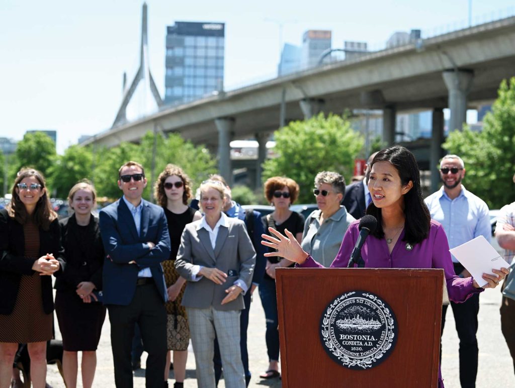
The announcement event was in Charlestown, at a Boston Planning & Development Agency city-owned, six-acre parking lot adjacent to Bunker Hill Community College (BHCC) and the Community College MBTA Orange Line station. The site is an example of land the mayor hopes to transform into affordable housing, green space or other public uses.
“In a city as dense and already developed as Boston, these parcels identified in the land audit represent rare opportunities to utilize public space for the public good,” Wu said.
Wu added that she hopes city residents will join in on the planning process using a digital mapping tool that has been released alongside the audit and an online feedback form which will be open through the end of the summer.

Chief of Housing Sheila Dillon addresses reporters at Bunker Hill Community College. PHOTO: ISABEL LEON, MAYOR’S OFFICE
“We’ll also be hosting a series of community listening sessions to get feedback directly from residents in our neighborhoods,” she said at the June 15 announcement event. “That’ll start right here in Charlestown, where we have the chance to turn underutilized parking lots like this one into the kind of community hub that our residents have been calling for everywhere across the city.”
More than 1,000 city parcels have been identified in the audit as vacant or underutilized, and according to city officials, a number of those are being considered “high opportunity sites” to prioritize for community planning efforts.
The sites include places like the BHCC parking lot as well as the Boston Public Health Commission’s Mattapan Campus, the East Boston A-7 police station, the Boston Water & Sewer Commission parking lots in the South End, the BPS Campbell Resource Center in Dorchester and the BPDA-owned Sargent’s Wharf parking lot in the North End. Most of the sites are not yet in a pipeline for development.
Chief of Housing Sheila Dillon, who hopes that much of the land can be transformed into new homes, said the city is at an exciting crossroads with new information and once-in-a-lifetime federal relief dollars to make better housing happen.
“We’re really excited to get going on making sure you can use those sites after community process, after community dialogue, to build new homes for people to buy,” Dillon said, “And then there are sites like this, which you know, we can do so much with, but I’m hoping — we’re working with communities closely — that housing is a very, very significant piece of these large parcels.”
A portion of the parcels — nearly 20% — that “present little opportunity for development or community use and should not be considered further for advancing community-oriented development according to the city.”
In the coming months, the BPDA and the Mayor’s Office of Housing will use both the report and the ongoing PLAN: Charlestown to move forward with transforming the BHCC parking lots. The process is likely to set the stage for the other parcels included in the audit and show what the process will look like moving forward with the mayor’s proposed innovations.
According to the city, the process also underscores the ongoing commitment to diversity in city development. As with all BPDA- and city-owned parcels in Boston, any request for proposal (RFP) released for public land must respond to the BPDA’s diversity and inclusion evaluation requirements and outline commitments to include minority- and women-owned business enterprises in all aspects of their development.
“The author gives us a chance to make sure that the development teams that develop this project reflect our city,” said Arthur Jemison, the city’s chief of planning. “We are going to be working together to make sure that every aspect of the planning needs to go on to make this site and many others different.”
To review the full land audit report and fill out community feedback forms, visit the city’s website, boston.gov.


