Is Grove Hall in Dorchester or in Roxbury?
It depends on who’s asking — or more importantly, who’s telling the story.
When the Pleasant Hill Baptist Church celebrated its 80th anniversary last month, the Humboldt Avenue church was placed in Dorchester by a Boston Globe reporter in an Oct. 6 story. Yet three days later, when a teenager was busted with a loaded handgun after he was spotted in the playground adjacent to the church, the incident occurred in Roxbury.

This 1880 map shows the boundaries between Roxbury, Boston, Dorchester and
Brookline 12 years after annexation to Boston. CITY OF BOSTON MAP ARCHIVE
While the historical boundary between Roxbury and Dorchester runs between Blue Hill Avenue and Columbia Road, Boston Latin Academy, which currently occupies the building formerly inhabited by Roxbury Memorial High School, was identified in a Globe column as a Dorchester-based exam school when it recently was promised a $2 million gift.
Such sudden shifts in geography are not new in Boston news media. In the aftermath of Charles Stuart’s 1989 murder of his wife, the local news media widely identified the Mission Hill location as Roxbury, although in other reporting the area has been described as the Longwood Medical Area or Mission Hill.
“Because there was crime involved, it was Roxbury,” former Banner Editor Brian O’Connor noted during a televised 1990 CSPAN roundtable.
The practice of using Roxbury to signify race goes back to the 1960s, notes former state Rep. Byron Rushing.
“It was the way you defined whether a person was black or white,” he said. “It didn’t matter what happened or where it happened, if they were black, it was ‘a Roxbury man.’”
The boundaries of Boston’s neighborhoods have long shifted in response to changes in the racial, ethnic and religious makeup of the city’s residents. While the Longwood area and the Fenway were part of Roxbury before it was annexed by Boston in 1868, shortly thereafter, Catholics living in the Parker Hill section of the neighborhood rechristened the area Mission Hill, in honor of the Our Lady of Perpetual Help Basilica that was built there on Tremont Street.
Rushing says race became a major factor in the imaginary boundaries between neighborhoods as the city’s black community began growing and shifting out of the South End.
“Starting in the mid-20th century, it was race that defined everything,” he said.
A political boundary
When the Puritans left Dorset, England and landed in Massachusetts Bay Colony in 1630, the primary divide was between the English and the Massachusett Native Americans already living in the area. The colonists established settlements including Boston, Newtowne (now Cambridge), Dorchester, Roxbury, Dedham and Charlestown. Over the next 200 years, Boston expanded, annexing Roxbury, Dorchester, Allston and Brighton (then part of Watertown) and Charlestown.
Not long after the Puritans arrived in Dorchester and Roxbury in 1630, their respective settlements had a boundary that stood for more than 200 years. The Dorchester Brook, which began at Gaston Street, formed a natural separation between Dorchester and Roxbury as they grew from two of the five original Puritan settlements in the Massachusetts Bay Colony into thriving towns.
In the 17th century, the Clapp family’s tidal mill, at the mouth of Dorchester Brook, was a major center of industry. The brook emptied into the South Bay, which at the time was an open body of water between the peninsula on which Boston was built and the mainland occupied by Roxbury and Dorchester.
In the 18th century, after Governor William Shirley had his 1751 mansion built overlooking the South Bay, his wife ordered the Dorchester brook widened and lined with stone.
“She ordered the brook to be channeled and straightened,” said Boston Archaeologist Joe Bagley, who recently supervised an archaeological dig at the site of the mansion. “They were extremely wealthy, so they designed the landscape to suit their tastes.”
The channel allowed wealthy visitors to the mansion to travel there by boat, rather than enduring a bumpy carriage ride through rural Roxbury.
The channeled portion of the brook was eventually converted to a culvert and, later, became part of the city’s sewer system.
Buried history
At the time of Roxbury’s incorporation into the city of Boston in 1868, the political boundary between the town and Dorchester was still intact. From the headwaters of Dorchester brook just south of Quincy Street, the border between Roxbury and Dorchester followed a straight line to Seaver Street, then followed Blue Hill Avenue to Harvard Street. At the intersection with Morton Street, the division traced a straight, southwesterly line to Dedham.
It wasn’t until Dorchester’s annexation in 1870 that that boundary began to dissolve.
The annexation of the towns coincided with their rapid urbanization, aided by their transitions from agricultural communities to industrial centers.
“There were tons of people moving into Boston,” Bagley said. “The pressure to build was tremendous.”
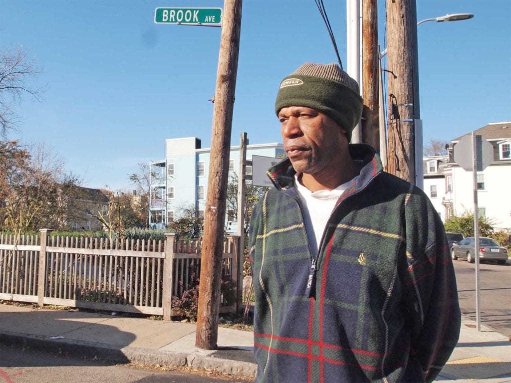
While traces of the brook can still be seen in street names, such as Brook Avenue and Brookford Street, the streets soon traversed the filled-in remnants of Dorchester Brook and the historical boundary between the neighborhoods became a little more murky.
Blue Hill Avenue and Franklin Park remained a firm part of Roxbury’s identity for the next 100 years. But when the U.S. Postal Service changed the name of the local post office from Grove Hall 02121 to Dorchester 02121, it set the stage for a half-century of confusion, often tinted by the racial attitudes and assumptions of reporters and editors.
Today the historical boundary is all-but forgotten, even by many Roxbury residents. Sitting on the porch of his West Cottage Street home, just west of where Dorchester Brook once ran, two men pondered the location of their Roxbury homes. Neither was aware of the historical border, memorialized in the name of Brook Avenue 25 yards to the east.
“Roxbury gets a bad rap,” said Mike Jones, explaining the neighborhood’s shifting boundaries. “You’ve got just as much positive vibes in Roxbury as you do anywhere.”
But asked where he lived, the Howland Street resident said he goes by the name of the 02121 zip code: Dorchester.
Rushing notes that the same prejudices that continue to shift Roxbury’s boundaries in the current era have also affected street names. When the black community on Beacon Hill settled on the back slope off of Belknap Street, white Beacon Hill residents in 1855 petitioned to change the front-side street name to Joy Street. The black Beacon Hill residents eventually changed their portion of the street to Joy Street as well.
“You could write a whole book on how race and class affect the naming of streets and places,” Rushing said.


